Mount Soho
- Mike Morelli

- May 22, 2025
- 2 min read
Date: May 23, 2025
Location: Harris Mountains, Arrowtown, Otago, New Zealand
Total Trip Distance: 16.7 mi / 26.9 km
Total Elevation Gain: 5,875 ft / 1,791 m
Trip Duration: 7 hours 45 min
Team: Solo
Field Notes: Bike, walk, or run up the 4WD track heading towards Macetown. At the junction with Soho Creek, head steeply uphill to the north, aiming for Point 1218. From here, continue north following the ridgeline along to Points 1608 and 1740, which eventually lead to the summit.
Rating: Hiking / tramping

It was a cold May morning as I peddled up the Arrow River. I always wondered what biking up the four-wheel drive track would be like. Within the first five minutes, I met my first river crossing.
I tried to skip across some rocks to avoid soaking my footwear completely. This proved foolish as I slipped, smashed my knee on a rock, and dunked one of my gloves in the cold river.
Classic.
From then on, I just plowed through any river crossings and let go of my attachment to dry footwear.

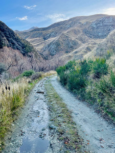

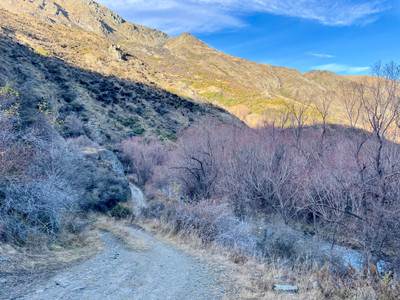
The track eventually stops zigzagging through the river and climbs two hundred meters along the windy road before dropping back down to my starting point for the climb at the junction with Soho Creek.
I ditched my bike, dropped some layers, filled my water, and started up a steep tussock spur. It was ten thirty in the morning, and the low Autumn sun still hid behind the mountain.


The air was still, and crickets chirped in the grass. My legs felt heavy and I focused on setting my all-day pace. Before I knew it I stood atop Point 1218 to greet the sun.
What a perfect day to be up high.
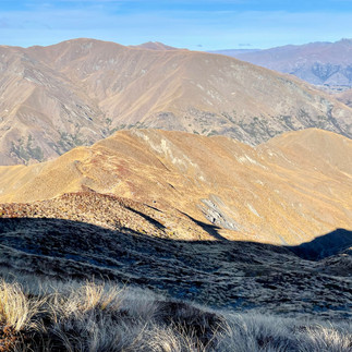
I followed the beautiful ridge up and around to Point 1608 and then on to Point 1740. From here, I finally spotted the summit of Mount Soho and walked the last ten minutes to the peak.


Other than the occasional wisp of wind, the air was completely still and silent. Three hundred and sixty-degree views in all directions with Mount Aspiring to the north, the Remarkables to the south, the Richardson Mountains to the West, and the Harris Mountains to the east.
It took me three casual hours to reach the summit from the river, and roughly two hours to get back down to the bike. Travel was straightforward and at times, a rough trail could be followed.

I arrived back to my bike late in the afternoon with the sun making its final golden descent. Fortunately, the ride out was much more down than up, and I reached my van in about forty-five minutes.
Happy days...


Comments